Planning a Tour of Namibia… Everything You Need To Know
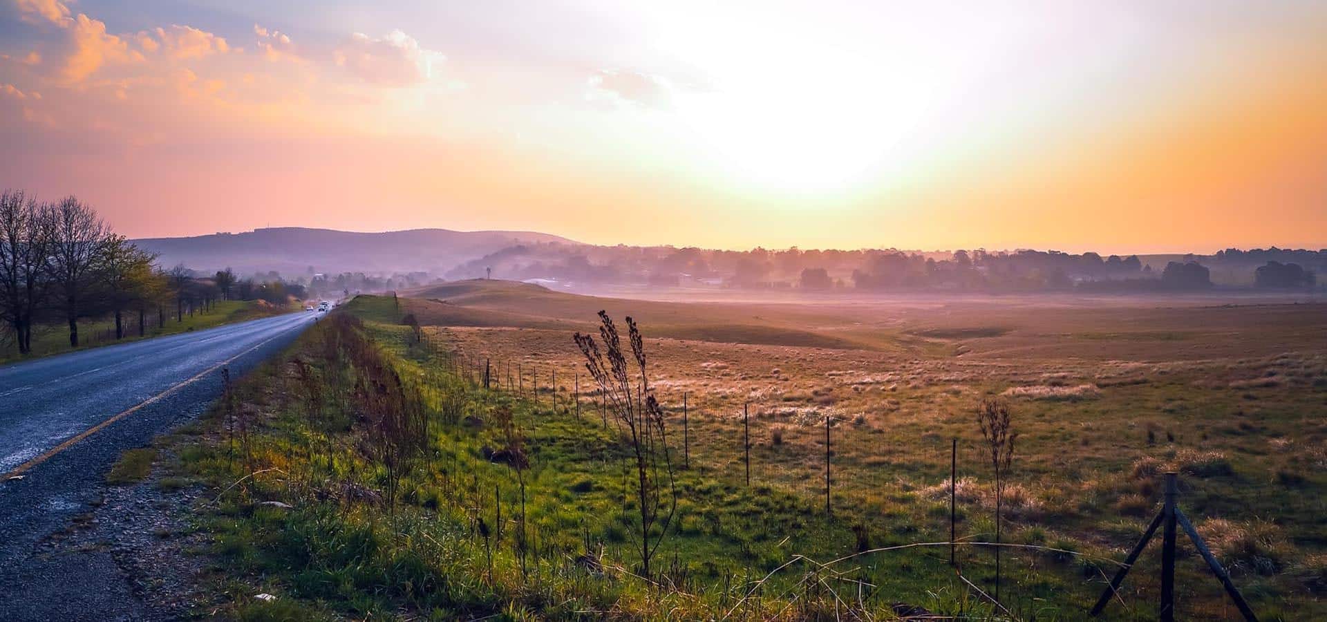
A tour of Namibia takes travellers through a land of extreme contrasts; from breath-taking lush landscapes in the Caprivi Strip to the treacherous shores of the Skeleton Coast. It is a vast country; sparsely populated and mostly uninhabitable. You don’t want to get lost in Namibia so it’s advisable to employ the services of a knowledge Namibia safari guide from Moafrika Tours.
Namibia’s popularity as an international tourist destination has gained momentum over the past decade and offers travellers and wildlife enthusiasts an experience that is vastly different from other places in southern Africa. The country is renowned for its warm hospitality aswell as its incredible scenery and wildlife.
A Namibia tour takes you from the icy Atlantic coast on the western border across wide open spaces to the more lush regions in the east. Your journey around Namibia should be taken at a tranquil pace with many spontaneous stops at vantage points and nights spent around a warm campfire while you contemplate the beauty of life.
Your journey around Namibia will take you to popular tourist attractions like Etosha, the Skeleton Coast and the Caprivi Strip. However, to appreciate the true natural wonder of this vast country, take a few detours off the beaten path to discover unknown places and its warm-hearted people.
TOP 10 TOURIST DESTINATIONS IN NAMIBIA
Skeleton Coast
As the name suggests, the Skeleton Coast is a harsh belt of desolate land running the length of the northern part of the Atlantic coast of Namibia. The inhabitable coastal zone is characterised by dense fog, terrifying storms and violent seas that have given rise to the Skeleton Coast being known as the world’s biggest ship graveyard.
The Khoisan believed that the Creator made this stretch of coast in anger and the Portuguese explorers called it the “Gates of Hell”. Many sea captains and their crew have lost their lives on this treacherous stretch off the coast of Namibia. Those that survived and made it safely to land faced the daunting task of making their way out of the barren, hostile coastal desert.
A fascinating attraction is the wreck of Dunedin Star, a massive ship that ran aground in 1942, and the story behind its fateful voyage. The surviving sailors built shelters on the beach and waited out an agonising time in vicious conditions before they were rescued.
The most attractive stretch of the Skeleton Coast is Terrace Bay, characterised by high sand dunes that offer visitors panoramic views of the vast arid landscape.
Etosha National Park
This world-famous national park is Namibia’s most popular tourist destination. The Etosha National Park surrounds a vast salt pan that is dry for most of the year. It only fills with water during the summer rainfall period and the park is transformed into a magical oasis.
Algae that grows in the wet season creates a blue-green hue over the massive salt pan and attracts thousands of flamingos to the area. A variety of migratory animals descend on the area, including large herds of elephant, wildebeest, zebra and antelope.
Caprivi Strip
The Caprivi Strip is a narrow strip of wilderness that lies between Botswana on the southern border, Angola and Zambia on the northern side and the Okavango region in the western territory of Namibia. The Caprivi Strip lies in a belt that experiences the highest rainfall in the country and has a number of rivers running through it, including the Okavango, Kwando and Zambezi Rivers.
Large concentrations of game are attracted to the Caprivi Strip in the rainy season because of its abundance of water and lush vegetation. The beauty of the Caprivi Strip is that the four major nature reserves are not fenced and the animals can roam freely across the borders into the neighbouring countries.
Fish River Canyon
This breath-taking canyon is immense, second only to the Grand Canyon in the USA. The landscape is characterised by a gigantic ravine which is about 160 kilometres long and up to 27 kilometres wide in some places. The canyon is almost 500 metres deep with a narrow strip of water flowing along its sand bed in the rainy season.
The Fish Rive is the longest interior river in Namibia and cuts deep into the plateau. Ai-Ais, a hot springs resort, is located at the end of the Fish River Canyon. This part of the canyon is part of the Ai-Ais/Richtersveld Transfrontier Park and is open to the public. Other ports of the 90 kilometre river are privately owned.
Sossusvlei
Sossusvlei is an expansive clay pan which is surrounded by massive red sand dunes. The dunes glow in the light of the rising and setting sun and it’s a popular destination for photographers. The Tsauchab River runs through this part of the Namib Desert and infrequent flooding sustains vegetation that managers to survive in the arid clay soil.
The Sossusvlei is known for its vicious desert winds that continually alter the shape and size of the sand dunes. The desert landscape changes over time as the sand dunes move at a painstakingly slow pace.
Swakopmund
Swakopmund is a popular coastal town, made famous by Brad Pitt and Angelina Jolie who chose it as the birthplace for their first child. The town is rich in German architectural history and its unique features stand out in stark contrast to the forbidding desert that surrounds the town.
Swakopmund is most popular as a destination for sports-loving tourists who have an abundance of activities to choose from; sandboarding down the massive sand dunes, horse riding and quad bike riding in the desert aswell as long walks on the expansive beach and dips in the cold sea.
Kolmanskop
A few kilometres inland from the coastal town of Lüderitz is a ghost town called Kolmanskop. The area was originally inhabited by German settlers who came to the area after diamonds were discovered in the region in 1908. Kolmanskop was built in an architectural style similar to an old German town and was once a thriving economic hub. The diamond field stopped yielding sufficient stones to sustain the villagers’ livelihoods and the town was abandoned in 1954. It became a ghost town which in itself is fascinating.
The unrelenting sand dunes swept over the town and buried many of its buildings. Tourists now walk through many of the houses in knee-deep sand. A mystical air hangs over the town and one can imagine what characters filled the homes that long ago reverberated with laughter and good cheer.
Twyfelfontein
Twyfelfontein is renowned for its large concentration of rock engravings. Most of the carvings were created over 6 000 years ago by an ancient San tribe more commonly known as Bushmen. The sandstone carvings depict scenes of rural life aswell as the abundance of wildlife that once roamed the area, including rhinos, elephants, ostriches and giraffes.
Cape Cross (Cape Fria)
The town of Cape Cross is famous for its colony of Cape Fur seals; one of the largest colonies in the world. The area was proclaimed a proclaimed reserve in 1968 to protect the seals’ breeding habitat. The peak breeding season is in November and December when as many as 150 000 seals descend on the Cape Cross.
The area earned its name from a large stone cross that was erected in the 15th century by Portuguese explorers. It was discovered in 1486 by the famous Portuguese sailor, Diogo Cão.
Also known as Cape Fria (meaning cold cape), the headland is located in the Skeleton National Park; about 200 kilometres south of the Angolan border. The area is extremely remote and can only be accessed via a charter airline.
Spitzkoppe
Spitzkoppe is a group of massive granite peaks that rise out of the red sands of the Namib Desert. Affectionately known as the “Matterhorn of Namibia”, the highest peak stands at 700 metres above ground level.
The enormous bald rocks were created when the surrounding land collapsed during a massive volcano that occurred some 100 million years ago. Several rock paintings are found in different spots, evidence that the San tribe (Bushman) once lived in the area.
THE HISTORY OF NAMIBIA
The country derives its name from the Namib Desert which is regarded to be the oldest desert in the world. It gained its independence in 1990 but prior to that it was a German protectorate known as South-West Africa. German is still the language most commonly spoken in Namibia.
Early tribal inhabitants
In the 14th century, the Bantu people travelled from central Africa and settled in the dry, arid lands. The Oorlam people from the Cape Colony arrived in the late 18th century and settled in the southern region of Namibia. The Bantu and Oorlam people co-existed in a peaceful manner with shared rights to waterholes and grazing lands. However, when the Oorlam moved northwards they encountered the more hostile clans of the Herero (located in what is now the capital city, Windhoek), the Gobabis and Okahandja.
The Nama-Herero War broke out in 1880 and the conflict was only contained once the German Empire sent troops to the region and restored peace and stability. This led to the prevalence of a strong German culture in the country.
The famous Portuguese navigators, Diogo Cão in 1485 and Bartolomeo Dias in 1486, were the first Europeans to explore the region. However, it was only in the 19th century that European traders and settlers attempted to lay claim to parts of the country and set up settlements.
In an attempt to prevent the encroachment of British settlers, the country became a German colony in 1884 under Otto von Bismarck. The Herero and the Namaqua people took up arms against the brutal German occupiers between 1904 and 1907 in what is referred to as the ‘first genocide of the 20th century’. The German authorities ordered the extermination of the hostile tribes and troops killed 10 000 Nama people (half the population) and 65 000 Herero (about 80% of the population). Many more were detained under brutal conditions.
The survivors were subjected to harrowing conditions that mirrored the Nazi occupation in the Holocaust and the apartheid system in South Africa. A policy of dispossession, forced labour, racial segregation and discrimination ruled the day, with most of the indigenous African people confined to so-called native territories. The German government would later issue a formal apology for the Namibian genocide.
The South African military defeated the German forces occupying Namibia during World War I and took over the administrative rule of the country from 1919. The United Nations argued that South-West Africa (as it was known in 1946) should be placed under a UN Trusteeship agreement but the South African government refused to cooperate. The apartheid system imposed by the National Party in South Africa was carried over to the governance of South-West Africa and the indigenous tribes continued to exist under its brutal rule.
Guerrilla war against South African rule waged under the rising power of South-West People’s Organisation (SWAPO). In 1971, when the International Court of Justice issued an ‘advisory opinion’ declaring South Africa’s administrative occupation to be illegal. The armed struggle for independence continued until 1988 when South Africa finally agreed to end its occupation of Namibia. The transition of power was overseen according to a United Nation Peace Plan, and a combined UN civilian and peace-keeping force called UNTAG was deployed from April 1989 to March 1990 to monitor the peaceful withdrawal of troops and the forthcoming democratic elections which were finally held in 1989.
Sam Nujoma was sworn in as the first President of Namibia (a new name chosen for a newly-independent country) and Namibia had its first taste of freedom, equality and independence.
Since its independence, Namibia has successfully transitioned from white minority rule to a multi-party democracy. The Namibia government has promoted a policy of national reconciliation and issued amnesty for those who fought on either side of the liberation war.
PLACES TO VISIT IN NAMIBIA OFF THE BEATEN TRACK
There are so many superb reserves and natural wonders to see on a Namibia safari tour over and above the well-known destinations like Etosha, the Caprivi Strip and the Skeleton Coast; it’s impossible to narrow them down to the top ten. On an adventure tour around Namibia with Moafrika Tours there a number of places to put on your must-see list.
The Waterberg
The Waterberg is located east of Otjiwarongo and is what the Germans call an “inselberg”; a small mountain or a big koppie (as we say in South Africa). It is a chiselled escarpment that rises out of the barren plateau and stretches along the western border of the Kalahari for 50 kilometres.
The mountain range is divided into two conservation areas; the Waterberg Resort in the west and the Waterberg Wilderness Private Nature Reserve. The area is a popular destination for avid hikers, with just rewards of an incredible view from the escarpment.
One particular trail is close to the Otjosongombe battlefield where Herero troops were overwhelmed by German troops in 1904. The bloody battle bought an end to the seven-month Herero uprising and marked the start of the Herero genocide. Historians will delight in its historical significance, with information boards marking the trail and telling the story of the battle and casualties.
Bogenfels near Sperrgebiet
The Bogenfels is a spectacular rock formation that is located about 120 kilometres south of Lüderitz. It is regarded by scientists as a geological wonder and a must-see destination for photographers. Visitors need a special permit to visit the Bogenfels arch which you can get as part of a tour to the abandoned mining town of Pomona in the Sperrgebiet area.
The arch rock tower is 55 metres tall and stands majestically with one leg in the Atlantic Ocean and one leg anchoring it in the Namib Desert. An air of desolation and isolation adds to its mystique as the Bogenfel is usually wrapped in a thick blanket of mist. At the very top of the arch there is a hole and, if you’re brave enough to withstand the vicious wind, you can look down through it to the crashing waves below.
Das Alte Fort in Grootfontein
Namibia is rich in military history and a visit to the Das Alte Fort will give historians their holiday fix. The museum is housed in a building that dates back to 1896 and was originally used as a Schutztruppe fort. Years later it was used as a place of safety for Angolan refugees during the liberation war.
Visitors can learn about the Dorsland trek, the history of mining in the area and get a first-hand glimpse of how people lived in such a remote area many years ago. The courtyard is filled with old wagons, carts and ancient implements like a chopping machine used to make fodder from prickly pears, a butter-wrapping machine and a machine to remove mielie kernels from the cob. A tour of Das Alte Fort takes visitors back in time and it’s worth a visit if you’re close to the town of Grootfontein.
The biggest tree in Namibia
Another fun place to stop if you’re in Grootfontein is the giant baobab tree which is the biggest of its kind in Namibia. The giant tree was declared a national monument in 1951.
The world’s largest meteorite
The Hoba meteorite is located between Tsumeb and Grootfontein. It was discovered by a farmer in 1920 and its celestial origin was finally confirmed in 1929 by scientists from the Smithsonian Institute.
The fascinating space rock is 3 metres wide and about a metre high, and weighs around 60 tonnes. It is made up of heavy metals that include iron, nickel and cobalt. Scientists believe it slammed into the dry desert region about 80 000 years ago and lay undisturbed for generations.
Dragon’s Breath Cave
This cave is quite spectacular and worth a visit for something totally out of the ordinary. The cave is located about 45 kilometres north-west of Grootfontein. Moist warm air can be felt at the cave’s entrance, hence its name. A hundred metres below the surface of earth is the biggest underground lake in the world that is not covered by a glacier.
The surface area of the lake is estimated to be the size of two rugby fields; nobody has reached the bottom and no one knows how deep the water is. Smaller caves are open to the public but the lake itself can only be explored by technical divers and skilled cavers.
Ghaub Cave is one of the more popular caves to explore but it’s not for the faint-hearted. You have to climb over slippery rocks and squeeze through narrow cracks. It gets hotter and more humid the deeper you go, and bats hang from the cave ceiling. The cave is estimated to be 7 million years old and many of the underground tunnels have yet to be explored.
Arch Rock in Spitzkoppe
Spitzkoppe is a magical tourist destination in Namibia and a highlight of a detour to this region is a visit to Arch Rock. If you are camping in the area, make sure you get up before dawn to make your way up the sheer rock face to a place where you can sit and watch the sun rise. The surrounding rock spires turn ochre as the light changes.
The word Spitzkoppe means pointed dome in German and describes a group of bald granite peaks located between Usakos and Swakopmund. The highest outcrop rises dramatically from the arid desert floor some 700 metres above the earth’s surface.
There are many examples of Bushmen rock art in the area which you can discover on a walking trail if you are overnighting in the small campsite nearby.
Welwitschia Plains near Swakopmund
The Welwitschia Plains are located between the Swakopmund River and Khan River, about 30 to 50 kilometres inland from Swakopmund. The area is famous for its high concentration of Welwitschia, a strange plant endemic to the Namib Desert. The Plains region lies within the Namib Naukluft Park, a proclaimed state-controlled area in Namibia that has been protected since 1907.
Some of the large specimens are estimated to be about 2 000 years old. These unusual plants have adapted to the extremely hostile conditions of the western coast of Africa, with wide straggly leaves that are designed to absorb as much moisture that rolls off from the icy cold shore.
Geo Centre in Rosh Pinah
The gravel road to Rosh Pinah (which means “cornerstone” in Hebrew) is one of the most scenic routes in Namibia. The area is an important mining belt and the tarred road takes trucks carrying zinc, lead and copper concentrate to the main port in Lüderitz.
Namibia is known for its living geology and geologists have a special affinity for the crystals and gemstones that are found in areas like Rosh Pinah. A fascinating collection can be found at the Geo Centre which is located on a small hill next to the main road. It’s an excellent spot to visit to find out more about the town’s two mines and the incredible riches that lie hidden underground the barren earth.
Organ Pipes and Burnt Mountain
These are two geological attractions that are popular detours when visiting the Twyfelfontein World Heritage Site. The Organ Pipes are dolomite formations that look like the pipes of a church organ. Burnt Mountain is a rock outcrop formed millions of years ago when the shale on the hill came into contact with magma and ignited. The heat scorched the underlying rock so badly that it now looks like a massive burnt mountain.
Both sites are excellent stops for avid photographers. Experiment with taking photos at different times of the day to capture the rich colours that change as the sun moves across them.
Petrified Forest in Damaraland
There are a number of petrified forests along the C39 route through Damaraland but the biggest one and the official site is aptly named the Petrified Forest.
Many years ago trees washed downriver and came to rest in an area where they were covered by sand. The sand prevented the plant tissue from decomposing and the trees eventually became as hard as rock. The sand covering the Petrified Forest eroded over time and these incredible geological wonders were exposed.
Tsumed Museum
Tsumed is a mining town and the last stop-over to stock up on provisions if you are heading to Etosha and the Caprivi Strip. The area is known for its caves, underground lakes and mines that yield a bounty of copper, lead, zinc, silver and other rare minerals. Some say if you dig a hole, you’ll find the periodic table.
An important chapter in Namibia’s history played out in this region and brought Germany’s brutal rule of South-West Africa to an end. At the start of World War 1, generals Smuts and Both landed in Swakopmund with South African troops. They invaded the interior in four campaigns and cornered the Schutztruppe in the north, where they cut off the coast.
In July 1915, the South Africans defeated the Germans which led to the signing of the Khorab peace treaty. The Germans in turn dumped their cannons and guns into Lake Otjikoto north-west of Tsumed and fled the country. In the early 1980s, divers brought the military artefacts to the surface which was no easy feat as the lake is 60 metres deep on average and connected to an underground cave system.
The cannons and other artillery retrieved from the lake are now kept in the Tsumed Museum. It also houses other items used by the German and South African armies and prisoners of war. The museum showcases the different cultures of the people of Namibia aswell as fascinating displays of crystals that have been extracted from the De Wet mining shaft. There is also an exhibition that provides information on the railway line that was built between Swakopmund and Tsumed in the early 20th century.
Caving in Otavi
If you are fascinated by the wonders of the subterranean world, a detour to Otavi is highly recommended to explore the labyrinth of underground caves in the area. The Uisib Caves are located in the Karstveld dolomite formations west of Otavi and are one of the more accessible caves in the area. The other one to explore is Uhlenhorst Cave which takes you down a chain ladder into a room full of strikingly-beautiful stalagmites and stalactites.
Sprokiesgrot Cave is equally impressive but slightly more challenging to explore. You need to crawl under low-hanging stalactites. Aigamas Cave has an underground lake which is the only known habitat of the golden cave catfish. These fish are almost completely blind and live off bat droppings, insects and small creatures that fall in the water.
GREAT RIVERS OF NAMIBIA
Namibia is described as a vast thirst land and much of life for humans, animals and plants alike revolves around surviving in dry, hostile conditions. The great rivers of Namibia cut through the arid wastelands, providing the lifeblood an abundance of precious water needed to sustain life in an otherwise inhospitable country.
Okavango River
This spectacular river course needs no introduction but it is more commonly associated with the Okavango Delta in Botswana. Known as the Kavango River in Namibia, the Okavango River forms the northern border of Namibia and Angola for more than 350 kilometres before it cuts through the Caprivi Strip of 50 kilometres as it makes its way to Botswana and the Okavango Delta.
Its water composition is low in minerals but high in bacteria levels which makes it an excellent water source for fish as it is rich in nutrients. It is one of the few remaining rivers in the world that where no exotic fish species have been introduced.
Game viewing along the river is excellent and you are guaranteed to see large herds of elephants, aswell as the rare roan antelope and the red lechwe. The river widens into large floodplains at a point called Bwabwata and resembles a mini Okavango Delta.
Kwando River
The Kwando River runs through the middle of the Caprivi Strip. It is much narrower than the Okavango River and slightly less spectacular but an invaluable source of water none the less. Spring rains in the Angola highlands feed the Kwando which in turn inundates the floodplains of the Mudumu National Park.
The Mudumu National Park is located in the Caprivi region in north-eastern Namibia. The wildlife reserve is managed through community-based conservation initiatives that are essential for the conservation of an important migration route from Botswana to Angola. There is no boundary fence and Mudumu forms a crucial trans-boundary link for wildlife migration between Angola, Botswana, Namibia and Zambia.
The western bank of the Kwando River runs through the Bwabwata National Park. At a popular safari destination called Horseshoe Bend you are guaranteed to see large herds of elephant and a wide array of birdlife. The floodplains nourish papyrus beds and marshland that act as fish nurseries and create a lush wetland that is ideal for migratory bird species.
Zambezi River
The Zambezi River forms the border between Namibia and Zambia for about 140 kilometres. It is regarded as one of the mightiest rivers in Africa and is nearly 500 metres wide in some places.
This spectacular river is world-renowned as an excellent destination for tiger fishing and birdwatching. Over 450 species of some of Africa rarest species of birds are found along the Zambezi River, including the Pel’s fishing owl, rock pratincole, African skimmers and Pygmy geese.
It is the fourth longest river in Africa, rising in Zambia near the border between the Democratic Republic of Congo (DRC) and Angola. It plunges over the Victoria Falls in Zimbabwe and meanders onwards for thousands of kilometres before it empties into the Mozambique channel.
Tourists have the choice of a number of high-end safari lodges that flank the Zambezi River which are an excellent base if you are crossing over into Zambia or Botswana. The Zambezi region is teeming in game which can be explored on a boat cruise that winds its way through the labyrinth of waterways and past riverine forests.
Chobe River
The Chobe River starts off as the Kwando River in Namibia and becomes the Linyanti River on the border of Botswana. The bulk of the Chobe River runs through Botswana but sections of it create vast floodplains on the Namibian side. There are no fences around Chobe National Park in Botswana and large herds of elephants, wildebeest, zebra and antelope wander across the borders enjoying the bounty in both countries.
The best way to experience the beauty of the Chobe River is on a late-afternoon river cruise which takes you on a windy route through the floodplains. Hippo and crocodiles are plentiful and you may spot lion or cheetah on the water’s edge. Buffalo in their thousands are a common sight, aswell as giraffe, zebra, jackal, wild dog and the brown and spotted hyena.
The usual antelope species are frequent visitors to the river banks but count yourself lucky if you spot the rare grysbok or oribi. Gave viewing aside, the Chobe River is a birder’s paradise with everything from the common lilac-breasted rollers and white-fronted bee-eaters to the more impressive vultures, snakebirds and marabou storks.
Kunene River
Only a narrow stretch of this spectacular river is accessible to the public but it’s worth a visit if you’re an avid birdwatcher. The river originates from a plateau in Angola and its many tributaries join up to become the Kunene River. It snakes through the arid desert landscape for thousands of kilometres before emptying into the Atlantic Ocean.
Large sections of the river are inaccessible even in a 4×4 vehicle and it is truly one of the most remote wilderness areas in southern Africa. The landscape is quite mountainous and the river banks are lined with palm trees and wild fig trees. A popular destination is the viewpoint which looks over a striking waterfall, Epupa Falls, and distant hills.
One of the main attractions of the Kunene River is its incredible birdlife. More than 300 species have been recorded in the region and a few of the biggest drawcards are the rufous-tailed palm-thrush, the Angolan cave chat and the Cinderella waxbill. This is the only place in southern Africa where you can see these rare species.
Adventure seekers will enjoy a “leisurely” cruise up the river which is known for its wild rapids, large concentrations of crocodiles and a few treacherous rock outcrops and cliffs.
The region flanking the Kunene River is wild and pristine with only a small smattering of villages located along the main route. The local inhabitants are the Himba people and an interesting way to end your stay is to take a tour of a nearby Himba village to see for yourself how the people survive in such a remote area and experience their warm hospitality.
THINGS TO DO IN WINDHOEK
Windhoek is the capital of Namibia and the administrative seat of government. It is located in the central region and is the epicentre of the country. The city is flanked on three sides by a range of mountains and is quite spectacular in its own unique way.
Windhoek is an eclectic mix of European influences and African culture. It has all the modern amenities and is regarded as one of the cleanest cities in Africa. It is rich in history having once been a German colony. Visitors to Windhoek should take time to get to know its military and cultural heritage to appreciate its historical significance.
Heroes’ Acre is a war memorial located on the outskirts of the city. It serves as a patriotic and nationalist symbol; a memory of great conflict and the struggle for domination. The Independence Memorial Museum is located at Windhoek hilltop and showcases everything related to the country’s struggle for independence and democracy. Another Windhoek attraction is a church named Christuskirche, the oldest church in the country renowned for its architecture and striking beauty.
A pleasant day can be spent at the Tintenpalast Gardens and the National Botanical Gardens, exploring the natural wonders of the country. Walking trails take you along pathways flanked with indigenous and exotic species, much of them left to grow wild as nature intended.
With some time to spare, you can take a leisurely walk in the Avis Dam Nature Reserve which is located on the outskirts of the city. It’s an excellent place for birdwatching or just to spend some time recharging your batteries. A popular picnic spot is located at what was once a thriving zoo.
The Namibia Craft Centre is the place to go to buy souvenirs to take home. The handcrafted wares are made by local inhabitants and capture the rich cultural history of Namibia. Top off your shopping spree with a meal and drinks at one of the many good restaurants in the city.
To experience the rich culture and hospitality of the local people, you can take a tour of Katutura. Two-thirds of the city’s population lives in Katutura and it’s an opportunity to experience their lifestyle and get to know the local inhabitants better.
THINGS TO DO IN LÜDERITZ
Lüderitz is a harbour town in southwestern Namibia, located on one of the least hospitable stretches of the Atlantic Ocean. The port was developed around Robert Harbour and Shark Island and has served as an important hub for the country’s diamond-mining industry. A popular tourist attraction is the Lüderitz Museum which has displays showcasing the town’s diamond-mining heritage.
Its name was changed to ǃNamiǂNüs in 2013; pronounced in the quirky click-dialect of the Khoisan people who inhabited the area many years ago. However, for obvious reasons, the town is still referred to as Lüderitz.
Lüderitz Bay was discovered by the famous Portuguese explorer, Bartolomeo Dias, in 1488 on his way home after his pioneering voyage around the Cape of Good Hope. Dias raised a padrão at the extreme western promontory of the bay, dedicating it to Sao Tiago (Saint James). A padrão was a large stone cross inscribed with the coat of arms of Portugal and placed as part of a land claim by numerous Portuguese explorers during the Portuguese Age of Discovery.
The limestone beacon stood for many years before it was eroded by wind, sand and surf. A replica of the original padrão was erected on the original site in 1988 and unveiled as part of the celebrations of the Dias quincentenary. The Site of the Original Dias Cross, situated at Dias Point, was declared a national monument in 1973.
The town of Lüderitz was in 1883. It began life as a trading post and a fishing and guano-harvesting town. When diamonds were discovered in the area, the quiet town enjoyed a sudden surge in prosperity. The diamond rush has long since abated and the town now serves primarily to support the port. Despite once being a hive of activity, the town has retained its quaint appeal and is relatively unaffected by commercialisation.
There are many historic buildings in Lüderitz that one can admire, including the Deutsche Afrika bank, the Railway Station, the Old Post Office, and Felsenkirche (the ‘church on the rocks’). Built from proceeds of the diamond industry and situated on the wonderfully named Zeppelin Street is the Goerke Haus. Other heritage buildings in the town include Goerke Haus, the Krappenhoft and Lampe building, Woerman House, Troost House, Kreplin House and the Turnhalle.
The Evangelical Lutheran Church is a prominent landmark located high on Diamond Hill. It was designed by Albert Bause who drew on the Victorian influences he’d seen in the Cape. Construction of the church began in late 1911 and was completed the following year. The brilliant stained-glass panel situated over the altar was donated by Kaiser Wilhelm II, while the Bible was a gift from his wife.
Shark Island is a small peninsula adjacent to the coastal city of Lüderitz in Namibia. Formerly an island, it became a peninsula from 1906 when an inter-connecting landfill doubled its former size.
THINGS TO DO IN SWAKOPMUND
Swakopmund is a popular holiday destination, particularly for families looking for the whole sand dune, beach and surf experience. For those interested in the country’s history, a tour of Swakopmund is a walk back in time. Remnants of the German occupation have been well preserved and a tour of the historical buildings is something not to be missed.
The coastal town was established as a German colony in 1892 and a few of the colonial landmarks to visit include the Swakopmund Lighthouse and the Mole, an old sea wall. The Swakopmund Museum is situated next to the lighthouse and houses documents of historical value. The elegant Swakopmund Railway Station dates back to the colonial era; it’s been refurbished and is now a popular hotel resort.
Woermann Haus was built in 1905 and includes the 93-step Woermann Tower that served as a strategic outlook post. The 104-year old national monument now houses a collection of some 50 000 books and is regarded as the finest public library in Africa. It also houses a permanent collection of Namibian art.
Hohenzollern Haus is an impressive colonial building with an illustrious past. The building was constructed for the young count Hohenzollern who was sent to Namibia because he had become an embarrassment to the family. The house served as a brothel when the German’s occupied the town.
The ultra-modern Kristall Galerie (gallery) is a popular tourist attraction as it houses an impressive collection of crystals, semi-precious stones and the largest display of a crystal cluster (14 kilograms) in the world. The Sam Cohen Library houses a vast collection of African literature, old photographs and maps.
If you are a birder, take a trip to Walvis Bay where the protected lagoon is home to hundreds of pink Greater Flamingo. The lagoon is one of the most valuable wetlands along the entire west coast of Africa. The muddy flats are also home to an array of pelicans, terns, grebes, plovers, gulls and wader species. Rare sightings of the red-necked phalarope, the chestnut-banded plover, the Damara tern and the common redshank get birders very excited.
There are about 50 restaurants in Swakopmund and most of them serve authentic German cuisine. Try dishes like pumpernickel and German-style bratwurst and bockwurst sausages.
Explore the dunes on the outskirts of town which are home to a fascinating array of reptiles and beetles. These small creatures survive against all odds in the barren dunes, having adapted in a spectacular fashion to long periods of water scarcity. The dune fauna includes the quirky web-footed gecko, the large Namaqua chameleon, the horned adder, desert wasps and the speedy shovel-snouted lizard.
A visit to Swakopmund always includes a tour of the Welwitschia Plains. Here you will find the most bizarre plant species called the Welwitschia. A few have been dated to be over 1 500 years old.
And for the adrenalin junkies, no trip to Swakopmund is over until you’ve ridden a quad bike across the massive sand dunes. The Namib Desert is a sensitive eco-system so quad biking is highly regulated and can only be done in areas designated for quad traffic. You can also give sand boarding down dunes a go aswell as skydiving and low-level microlight flights up and down the coast.
THINGS TO DO ON THE SKELETON COAST
It goes without saying that this treacherous stretch of the wild Atlantic shore should only be visited with a tour operator if you are unfamiliar with the area. The Skeleton Coast is one of the loneliest places in southern Africa and renowned for its hostile conditions and bone-bleached desert wastelands.
Henties Bay is a popular destination for extreme anglers as the area is famous for its shark and game fish, such as galjoen and kabeljou. The bay was named after Major Henti van der Merwe, a farmer who stumbled across a freshwater spring while on a hunting trip in 1929. The small town has grown from a cluster of fishing huts to a premier leisure-fishing destination.
The Cape Cross Seal Reserve is located 53 kilometres from Henties Bay. A breeding colony of between 150 000 to 200 000 Cape fur seals are resident in the reserve and you know you are close to the breeding site by the pungent smell of guano that hangs in the air. The bleating ewes and lambs drown out any chance of a quiet conversation.
The reserve was named after the stone cross that was erected by the Portuguese navigator, Diego Cão, in 1486. He was the first European to set foot on the Namibian coast. Two replicas of Cão cross have been erected in its place as the original stone cross was taken to Germany.
The Skeleton Coast National Park is located on a narrow tract of coastline between the Ugab River and the Kunene River. It was proclaimed a nature reserve in 1971. The infrastructure has been kept to a minimum and the number of visitors is limited to protect the area. Tourism is restricted to two angling resorts.
A trip inland to explore the living dunes is an integral part of a tour of the Skeleton Coast. A typical dune formation is the crescent-shaped barchan which is formed by the prevailing southwest wind. The dune moves in a north-easterly direction with speeds averaging between 2 to 3 metres a year. Sightings of hungry black-backed jackal are common aswell as the brown and spotted hyena. Antelope such as the springbok and gemsbok have adapted to the harsh desert conditions and common sightings.
THINGS TO DO IN ETOSHA NATIONAL PARK
The Etosha region is a dry and desolate expanse of land but it possesses a unique beauty and ambiance that leaves visitors yearning to return. The name means “place of dry water”; however, a visit to Etosha National Park will reveal that the region is in fact a rich mix of wildlife and birds.
The Park is home to more than 340 species of birds of which 40 species are raptors. In addition, the region attracts thousands of flamingos that flock to the Etosha Pans to feed on the algae that forms on the surface water.
Self-guided game drives are allowed but for an outstanding experience it is recommended that visitors to Etosha National Park go with an experienced and knowledgeable guide. Etosha only has the Big 4 as buffalo are not found in this part of southern Africa. There is an abundance of game in the reserve, with exciting sightings of elephants, rhino and leopard. Rare sightings of the endemic black-faced impala, cheetah, silver-backed jackal, gemsbok, kudu and hyena add to the excitement of an Etosha safari tour.
The best place to see game in Etosha National Park is at the waterholes. More exciting is a visit at night-time to three waterholes that are lit by floodlights. Expect to see herds of elephants and a pride of lions that come to the waterholes when the sun sets to quench their thirst after a long, hot day in the bush.
Probably the most spectacular attraction is the Etosha Salt Pan which is a bare expanse of land that covers about 25% of the national park. It is so big and barren that it can be seen from space. The pan was once a massive inland lake that was fed by the Kunene River in Angola. Due to tectonic changes, the area dried up and it is now a massive salt pan.
The Etosha Salt Pan attracts an array of wildlife and birds that descend on the area to snack on the mineral-rich salts. The salt pan remains dry unless there are very heavy rains but even then the salt pan can only hold water for a limited amount of time.
THINGS TO DO IN THE CAPRIVI STRIP
The Caprivi Strip is renowned its wildlife and is a birders’ paradise but it is probably more famous for being the top sporting fish destination in Africa. Five mighty rivers flow through the Caprivi region; the Kwando, Okavango, Linyanti, Chobe and the Zambezi Rivers. The Okavango River is ideal for tiger fishing, while the Kwando River is more popular for bream and nembwe.
The Caprivi Strip is made up of a number of reserves and a national park and you can game view by boat or on land. Impalila Island in the far eastern corner is situated where the Zambezi and Chobe River which makes it a sought-after tourist destination.
The border of Botswana is not fenced so game moves freely from area to area. You’re guaranteed to see large herds of elephant, lions, leopards and wild dog. You’ll also see a variety of antelope including the lechwe, roan antelope, sable, tsessebe, sitatunga, reedbuck and waterbuck.
Guided bush walks are popular or you can enjoy a leisurely cruise on a floating pontoon. Evening game drives are a good time to spot game. Of course, birding safaris are also very popular considering the area has 400 recorded species of birds.
THINGS TO DO IN DAMARALAND
Damaraland is regarded as one of the most scenic destinations in Namibia. The region is characterised by vast open spaces that are harsh, yet strikingly beautiful. A prehistoric water course winds its way across open plains and grasslands and massive granite koppies and deep gorges lend it a rugged appearance.
In the western corner, an elusive herd of desert-dwelling elephants roam that region aswell as black rhino, giraffe, ostriches, lion, zebra, gemsbok, oryx and springbok have adapted to survive in the hostile desert environment. These animals travel vast difference between feeding grounds and scattered waterholes in the dry season.
A popular way to explore this expansive area is taking a scenic flight over the Damaraland. From the air you can appreciate the vastness of the region and the dramatic landscapes and dry riverbeds.
There are a number of things to do in Damaraland apart from searching for elusive animals, many of them revolving around exploring unique geographical landmarks.
The Brandberg (meaning fire mountain):
Namibia’s highest mountain and home to the famous ‘White Lady’ Bushmen rock painting. The Brandberg is named after the effect created by the setting sun on its western face, which causes the granite massif to resemble a burning slag heap glowing red.
It was initially believed that the ‘White Lady’ was painted by a European woman and in recent years there has been some debate as to whether it is actually a female. The central figure is depicted in a bizarre hunting procession which includes several women, one of which has skewered an antelope with gemsbok horns and striped legs. The White Lady is painted holding a wine glass in one hand and a bow and several arrows in the other.
Twyfelfontein (meaning doubtful spring):
A magnificent rocky outcrop renowned for its vast collection of Bushman engravings. The main attraction is a large gallery of rock art painted by the ancient San people and estimated to be the most extensive collection in Africa. Two other fascinating geological features in the area are the Organ Pipes and the Burnt Mountain.
Spitzkoppe:
a pointed inselberg (small hill) that was a regarded as a spiritual, sacred place for the ancient San people. Its name was chosen to describe it unique shape which is a sharply-pointed peak. Spitzkoppe is the remnant of an ancient volcano, formed in much the same way as the Brandberg and Erongo massifs.
The granite peaks of Spitzkoppe are part of the Erongo Mountains which are estimated to be more than 700 million years old. The area is a protected reserve but day visitors can explore the area and its ancient art gallery on foot. Look out for the Yellow Butter and Poison trees who extracted the white juice for poison for their arrows.
The Petrified Forest:
Fallen rocks that formed into rocks after they were buried under sand, and finally exposed when the sand eroded. The Petrified Forest is estimated to be millions of years old.
The Tropic of Capricorn:
In the Namib Naukluft National Park, which is located near Swakopmund, you will find a point marking the Tropic of Capricorn. This is a point where the sun is in zenith in the Southern Hemisphere and then turns back north until it reaches the Tropic of Cancer in the northern hemisphere. It’s a chance to take a break from your long trip for a once-in-a-lifetime photo opportunity.
A stick placed in the sand on the 21 December (the December solstice) will not throw a shadow as the sun is directly overhead. This event only occurs on one day of the year and is a real bucket-list moment.
THINGS TO DO IN KAOKOVELD
A tour of Kaokoveld is not for the faint-hearted and usually involves long, seemingly endless daily drives across miles and miles of forbidding sand dunes. There are only two operators in Namibia who are allowed to go into the area and travellers need to take everything they need in their 4×4 vehicles as there are no convenience stores or fuel stations along the route to stock up on provisions.
Those travelling to the Kaokoveld also have to be well-practised in driving on sand dunes but your tour operator will give you a crash course before you head out.
The Kaokoveld looks bone dry and lifeless for the majority of the year but when rain does fall, the desert comes alive. Herds of springbok and the elegant gemsbok descend on the open plains that are covered in tasty grass.
The most popular destination is Hartmann’s Valley, with your first stop at Oranjedrom (Orange Drum). Then it is onto the Ondusengo River and the Khumid River which is a dry riverbed that attracts a smattering of desert-dwelling giraffe and other weather-beaten game.
Dry rivers in the Kaokoveld like the Uniab, Hanib, Khumid and Ondusengo branch out across the desert like a network of capillary vessels, with their water source running deep underground. Layers of rock in the desert force the underground water to the surface in places like Leyland’s Drift which creates a magical oasis for many animal and plant species. You may even see a pride of lions at these water sources.
The Khowarib Schlucht community camp is located inland of Möwe Bay and positioned on the Hoanib River. It is an initiative of the government to empower local inhabitants to protect the country’s valuable natural resources and at the same time earn a much-needed living. The camp is positioned at the edge of Leyland’s Drift which is a scenic gorge with a view of the Hoanib River.
The road from the Khowarib Schlucht camp takes you onto the delights of Twyfelfontein, and Henties Bay and Swakopmund on the coast. The entrance to the forbidding Skeleton Coast is at Ugab Gate or you can take the C34 to Cape Cross to see the largest breeding colony of Cape Fur seals in the world.
WEATHER IN NAMIBIA AND BEST TIME TO VISIT
Namibia has a subtropical desert climate and typically experiences great differences between day and night-time temperatures. Rainfall is higher in the far north, including popular tourist destinations like Etosha and the Caprivi Strip in the Zambezi region. The climate in the southern region is hotter and drier.
The dry, winter season is between May to October. There is little to no rainfall and humidity is low. Game viewing is at its best around waterholes and along river banks when water is scarce. In the middle of the winter season (June) temperatures plummet at night to below 10°C. Daytime temperatures can be quite pleasant, around 20-24°C.
The summer season starts in September or October. This is a lovely time of the year to visit Namibia as the days are not too hot and the nights are not freezing. Temperatures start to rise from November and it can get unbearably hot, particularly in the dry, arid desert region.
The first rains usually occur in December. The landscape transforms into a magical oasis and everything bursts into life in the wetter northern region. Summer peaks in January and February, with temperatures reaching into the high 30s and low 40s. Rainfall decreases in March and stops around April. The nights get cooler but the day-time temperatures are pleasant.
INFORMATION FOR CROSSING THE NAMIBIAN BORDER
The following documents are compulsory requirements:
- Passport: valid for 6 months or more from the date you plan to leave Namibia and should have at least 2 blank pages on it.
- Birth certificate: Any child under 18 years needs an unabridged birth certificate
- Driver’s license: A valid South African licence which is accepted in Namibia
- Vehicle registration documents: Copies of these documents for the vehicle, trailer or caravan
- Letter of authorisation: If your vehicle is financed through a bank and you are still paying it off, you need a letter from your finance bank authorising you to take the car out of the country. If you are driving a vehicle that belongs to someone else, you need a letter from the owner of the vehicle giving you permission to take the car across the border.
- Emergency triangle: at least one triangle per vehicle
- ZA sticker: stuck on the back of your vehicle
IMPORTANT INFORMATION FOR A HAPPY TOUR OF NAMIBIA
The rand is equal to the Namibian dollar and rand is usually accepted everywhere. Always carry enough cash with you as prices at the border and fuel prices can go up without warning. There are no convenient ATMs in the middle of the desert.
South Africans may visit Namibia for a period of 90 days without a travel visa.
It is recommended that visitors to Namibia take malaria tablets, particularly if you are travelling to the wetter regions in the northern region.
Medical insurance is recommended as you may find yourself miles away from the nearest hospital and, for a medical emergency, may need to be flown out of the area.
No meat may be taken over what is known as the Red Line. This veterinary cordon fence runs across the breadth of Namibia and was erected to prevent the spread of foot-and-mouth disease. There are check points where the Red Line crosses main routes and you may be stopped to have your cooler box inspected. You may also have to drive your vehicle through a dip trough filled with disinfectant and dip the soles of your shoes in a shallow basin.
Hunters need a letter of authorisation from the owner of the farm where game will be hunted, giving permission for the person to brink rifles across the border. You are allowed to bring 500 kilograms of raw meat and 100 kilograms of biltong across the border as long as you have obtained a hunting permit and a South African Veterinary Import Permit. No port may be taken across the border, either way.
Anglers need to buy a Recreational Import Permit from the SA Department of Fisheries if they are returning home with their catch. A fisherman may bring back up to 30 fish to South Africa.
Visitors are not allowed to take their own braai wood or mealie meal across the border.
It is recommended that you write down the serial numbers of your camera, lenses, and cell phone and GPS devices before you cross the border into Namibia. Tourism officials and traffic police can sometimes get difficult if they think you’re smuggling goods into or out of the country.